Top Menu
Today's Weather
2024. 4. 27
21℃
Clear
Find dust Normal
/ Precipitation 0mm

Main Menu
Main Menu toggle
Close Main Menu
 Close Main Menu
- Introduction
Introduction
- Greetings
- General Information
- How to Get Here
- Sister Cities
- Sister Cities in Korea
- Sister Cities Overseas
- Wangqing County, Jilin Province, China
- Dongying City, Shandong Province, China
- Kurobe, Toyama Prefecture, Japan
- Akabira City, Hokkaido, Japan
- Kanda, Fukuoka Prefecture, Japan
- Kungur, Russia
- Leesburg, VA, USA
- Mareeba Shire, Queensland, Australia
- Jixi City, Heilongjiang Province, China
- Korsakov, Russia
- Tourist Attractions
Tourist Attractions
- Festivals
Festivals
- Tour Information
Tour Information
All menus
All menus toggleSister Cities Overseas
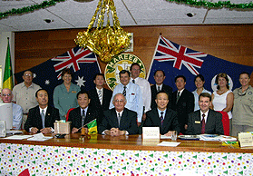
Mareeba Shire, Queensland, Australia
General Information
Location: 64km south west of Cairns
| Population | Area | Administrative Organizations | Administrative Departments | No. of Public Officials | Income | No. of Council Members |
|---|---|---|---|---|---|---|
| 18,096 | 53,644㎢ | Town 10 | 12 | 230 | ,000 | 9 |
Overview of Administrative Divisions (Towns and Districts)
- Mareeba – The largest town and the central administrative area in Mareeba Shire
- Kuranda – The largest tourist destination in Mareeba Shire, attracting 900,000 tourists every year
- Dimbulah – A town that services nearby farming areas
- Chillagoe – A cave tour city that has Chillagoe Mungana Park and limestone caves
- Mt Molloy – A former mining area with a lot of well-preserved historic sites and municipal campgrounds
- Julatten – A wildlife reserve and bird-watching area that is home to more than 300 types of birds
- Mt Carbine – Caravan Park and accommodations
- Irvinebank – A former mining town registered as a cultural heritage village
Key Exchange Areas
-
Mutual Exchanges in Administrative Sector
- Information exchanges and increase of understanding through mutual overseas training of public officials
- Learning and sharing advanced administrative systems through of an administrative cooperation system
- Culture and Arts: Exchanges between cultural and art organizations in the private sector
-
Education and Sports
- Student exchange programs through establishment of sister universities, elementary, middle and high schools
- Taekwondo exchange program for citizens and students as well as other sports-related exchanges
- Social and Environmental Sectors: Mutual exchanges in specialized areas